- PROJECT MOTHER
- someone
- Information for Middle and High School Researchers
Deep learning paints a picture of the Earth.
2020.10.05

Japan Agency for Marine-Earth Science and Technology
Information Engineering Program, Value-Added Information Creation Division
Associate Vice President for Research Daisuke Sugiyama three

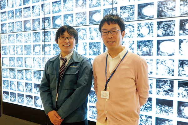
▲ Daisuke Sugiyama (left) and Daisuke Matsuoka (right) from the same team are interviewed about their research on tropical cyclone egg detection.
Have you ever heard of machine learning or deep learning? These technologies, which are used in various fields related to artificial intelligence (AI), are being used to study various phenomena on the earth.
Find the eggs of weather disasters in the images.
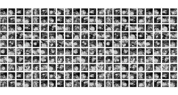
Deep learning, a field in which Daisuke Sugiyama of JAMSTEC excels, automatically deciphers features from a large amount of data, such as images, to make judgments and predictions. Using this method, Dr. Sugiyama and other JAMSTEC members have dealt with a variety of natural phenomena. One example is a system to detect tropical cyclones at an early stage. JAMSTEC also conducts research on weather simulations and has a large amount of data on tropical cyclones. Using this data, we can identify cloud patterns in the egg stage before a tropical cyclone develops. We have learned from 50,000 cloud images of tropical cyclones and their eggs, and 1 million images of clouds that did not develop into tropical cyclones. In the future, the team aims to establish a method for detecting tropical cyclones using actual satellite images without human subjectivity.

▲︎ Cloud images at the time of a tropical cyclone, learned by deep learning. By learning a large number of images, highly accurate judgments can be made.

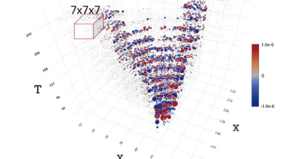
▲︎ 3D structure of seismic waves generated in Kanto propagating through the Japanese archipelago. Time lapse is represented as piling up from the bottom to the top of the T-axis.
Massive amounts of data are the key to unlocking how the world works.
Sugiyama also applies deep learning to earthquakes. Simulated seismic waves of various sizes and epicenter locations can be used as training data for 3D structures. Eventually, he expects to be able to develop a system that can automatically estimate the scale of an earthquake and the location of its epicenter from this data at high speed.
Thus, deep learning is good at learning a large amount of complex data, such as cloud images and seismic waves in 3D structure, in a complex manner and producing highly accurate answers. On the other hand, it also has a disadvantage in that the resulting decision formulas are complex and difficult to understand. While conventional science has developed by searching for simple, essential formulas that capture the mechanisms of the world, deep learning takes the exact opposite approach. In order to find the essential formula, we need to make use of other machine learning methods. If we can freely use various types of machine learning, it may become possible for anyone to solve the mechanisms of the world, which until now could only be discovered by a single genius," says Sugiyama.

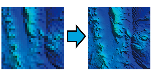
▲︎ Image of super-resolution of submarine topographic maps. It is expected to be able to draw a high-resolution topographic map (right) from a coarse topographic map (left).
A precise topographic map reveals the Earth's shape.
Another technique that makes use of deep learning is super-resolution. By preparing a set of high-resolution images and a set of coarse, low-resolution images of the same image and learning conversion equations between the different resolutions, this technology can calculate a high-resolution image from only the coarse, low-resolution image, as in, "If this pattern is seen, the detailed image should look like this. Now, efforts are underway to reveal a detailed topographic map of the seafloor using this super-resolution technique.
In fact, only 19% of the world's seafloor topography is known, and the area where high-resolution topographic maps are available is even more limited. In order to obtain high-resolution topographic maps over a wider area, super-resolution is being applied by JAMSTEC'sResearch project "Mathematical Bathymetry ScienceisThe following is a list of the most common problems with the
In this project, we are trying to develop a technique to estimate a high-resolution topographic map of an area where only a low-resolution map is available by learning the pattern between a low-resolution map and a high-resolution map acquired by a multibeam sonar or a surveyor.
If we can draw a precise bathymetric map over a larger area, we may be able to predict more precisely how the tides flow and how fish and other organisms move within the area. It would also be useful to determine where and how much resources lie on the seafloor. When all the seafloor topographic maps of the earth are completed, we will be able to get a closer look at the true shape of the earth.
(Text: Masaki Kimura)
